Wednesday, July 29, 2009

Grand Canyon West Skywalk

Tue 7/28 afternoon.
After completing my gocaching on Route 66 and ending it in Kingman, I decided to drive to the Grand Canyon West where the Skyway glass bridge is located. The last section of the road is 14 miles of dirt road under construction. But its well worth the trip. The road will be completely paved with in two years. You arrive at the first terminal for parking and to purchase tickets. Cost for Tour bus and skywalk is $75.00 or bus only $43.00. The bus will take you to Eagle point where the skywalk is located. After spending some time there, one gets on the bus to Guano Pt where U can hike or just walk around. The canyon views from both area are just awesome. This whole area is located on the Hualalpai Indian Reservation. Fun afternoon. You can go to my Web album to see alot more pictures.

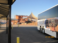
Entrance to center


Cool tour buses to the two view points


Eagle Pt- view of the Col. river

Eagle Pt- canyon view .
Looks like a eagle with the wings spread out

Eagle Pt - glass bridge


Center of glass bridge.
Had to pay for photo. Cannot use your camera . View thur the glass floor is about 5000 ft drop.

Looking out to the canyon, great. Looking down thru glass gives u the willies

Heading back - 14 miles of dirt road

Going my way?

Paid photos
Paid photos


Tuesday, July 28, 2009

Rt66 geocaching 7/28 tue

Tue 7/28
Made my plans to do some geocaching, Route 66 from Seligman to Kingman. Great fun driving thru some of the old towns that were very popular during the Hay-day of traveling on Rt66. Very interesting to see things that I remember in my child days. Old gas stations were the pumps were glass so one could see the gas. Old deserted motels. The two lane road is well maintains. Lots of people doing the same thing. Found all 10 geocaches. Some of the areas I went into were just cool.

The starting point. On to Route66 from I-40


Here in Seligman. A burger place called Snow cap. Pic are outhouses. But modern :) A geocache located here. Very busy place.

Cool stuff

Self timer shoot.

All kinds of old cars.
Here at Grand Canyon Caves off Rt66- Pic taken inside Lodge.

Had to climb this hill off Rt66 to get to a geocache. Great views. As U can see, long train came by...

Same hill- path to top

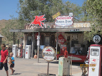
Stopping point called Hackberry- more Rt66 stuff.

cool car


Monday, July 27, 2009

Lighting show sun eve 7/27


Sunday evening for serveral hours here at the RV park. Mother -nature provided a awesome light show. Lighting was displaying every few mintues. The sky would be so bright. Yes. lots of thunder, then later heavy rain. Picture taken by co-workers Kathy/Derek, three spaces down from me.

Tuesday, July 14, 2009

geocaching Hwy89a 7/14

Geocaching from Flagstaff to Sedona on Hwy 89A tue 7/14
The four of us, Kathy/Derek, Kim and myself started out this morning about 7:30am from Meteor Crater to do some geocaching. Our goal was to find 13 caches, turns out we only found 11 of them. The other two we could not find.
The Hwy 89 A is awesome-- great views along the way. About 3 miles short of Sedona we stopped for a late lunch. Went back the same way to MC. Kathy/Derek planned a BBQ for us and other co-worker from the Crater at 5pm. Fun Day.


Our first stop- great view and short walk to the cache.

Stopped at a Forest Service viewing area into Oak Canyon.


The four of us: me, Kim, kathy/Derek

Same area, about 10ft inward was the cache.

The one cache we couldn't find. Oak creek. The house in the background was beautiful. Flowers going up the driveway. This setting was awesome.

More of Oak creek


They called this the Vortex view.. Beside picking up another cache in front of the Deli, nice place to eat.

This place is called the Indian Gardens--nice garden setting


Tuesday, July 7, 2009

geocaching via Camp Verde 7/7

Tue 7/7/09
The four of us from Meteor Crater, Kim,Kathy/Derek, & myself started out early to make a trip to camp Verde. Our first stop was off of I-17 to a cache called Weir Wolf doing a small hike into a canyon to see a old dam (weir means dam). Stopped for a few more caches. The last one was called Noah's Ark II which was a hike to the top of the plateaue above the cliff dwellings. This was a hard one. We did find the plastic container :) . When we returned to the Jeep we decided to go have lunch at the Cliff Casino and return home. Fun day.


Trail s- going up!


Cliff dwellings - cache located at the top.


Kathy & Derek at top where the cache is located


A little friend we saw on the way back.